Less searching.
Better investigating.
FrontageRadar helps billboard operators and site-acquisition teams narrow a large parcel universe to locations worth a closer look.
Try the public product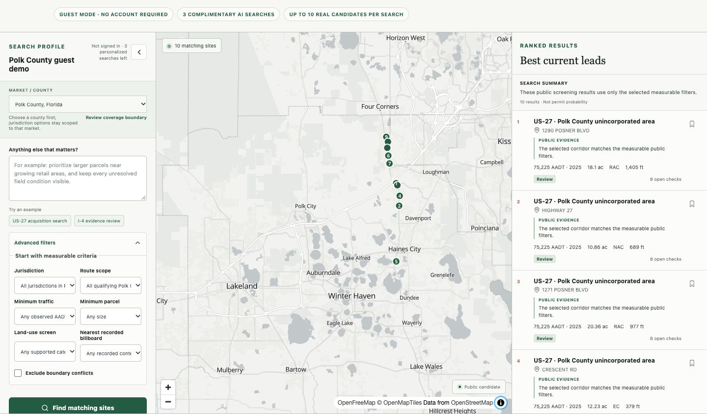
A map is only the beginning.
A promising location depends on traffic, parcel characteristics, land use and jurisdiction-specific conditions. These facts live in different sources, with different review dates and different gaps.
The task is to connect those sources into a practical screening workflow—and keep uncertainty visible when the evidence cannot support a conclusion.
One connected workbench.
Describe the search
Start with a corridor and measurable filters. AI can help interpret the request; users can inspect and adjust the criteria.
Inspect the evidence
A map and ranked results bring location, traffic, acreage and land-use evidence together. Source context and unresolved checks remain attached to the candidate.
Move into the workspace
The account-based workflow supports shortlist, comparison, tracking and candidate briefs. The public guest demo exposes a limited set of real candidates without sharing private owner or contact records.
Useful AI. Stable facts.
Data ingestion and normalization, a versioned geospatial database, screening logic, map interactions and account-based workflows form the product. AI assists with intent and explanation; it does not get to invent parcel facts.
This is how we approach an AI-enabled product: define the boundary between model output and verified data, give users a way to inspect the result, and build the rest of the system around that boundary.
Bring this approach to your productA public pilot, with clear limits.
The public launch covers Polk County, Florida. The guest experience shows up to ten real public candidates. Further Florida counties are in preparation; availability is maintained by the product itself.
Screening prioritizes investigation. It does not establish permit eligibility, title, constructability or lease economics. Open questions still require source review and field verification.
See current coverage and boundaries